|
|
|
|
|
the Ballachuillish Horseshoe came into view as I reached the top of the saddle - so much for the weather forecast!! If I had started out earlier, I could have done Am Bodach on the way - not that I was in Munro-bagging mode at all!!
On Tuesday, Phil and Gary kindly offered to drop Mike and me at the bottom of our respective walks whilst they finished cleaning the hut, packed the car and made a long traverse of Fort Bill High Street with detours to Nevisports and the Fish and chip shop. Mike did the Buachille Etive Mor Ridge while I did the Hidden Valley. At the top of the waterfalls, I decided to scramble up to Beinn Fhoda by a steep gully and to return through Lairig Eilde to the waterfall and back to the car. There was a superb view of Aonach Eagach from the top - between the blizzards - and of Rannoch Mor, Stob Dearg and Buachille Etive Beag and Stob Dubh.
Evenings were spent in the Carn Mor Hotel next door to the hut, Jane and Dave celebrating their sixth wedding anniversary in style in the restaurant, the rest of us imbibing ale and sampling the local whiskies - I can recommend Oban - and enjoying the convivial company.
Phil drove us home at great speed, Mike kept his eyes shut all the way!!
Anne Berk
|
|
|
|
|
|
|

|
|
|
|
|
|
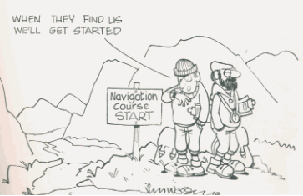
has various navigation screeens to give you your bearing, speed over ground and ETA. You can feed in the GR's of up to 200 landmarks and create 5 routes. These can be fed in before you go out on the mountain, which can be useful in misty conditions, as it will point the way to go.
I have always had the suspicion that these would not be too helpful on the mountains, as, with the poor level of accuracy you are likely to be directed over the edge of an arete or a cliff, and its usage so far has proved this to be so. Still, I could have done with it in the mist on Black Peak last year, when we couldn't find the triangulation pillar at the top in the featureless landscape.
I took it up Aonach Eagach on the second day, to assess its use once again. Here, I found it useful to give us a GR and altitude to locate us on the map, then the normal tools of navigation can take over - there is no substitute for compass work and pacing in low vis conditions. I think it is much too bulky really to be carried around all day. The best way to utilise it would be to produce a unit that can be worn on the wrist, rather like the computers we have in diving - it could have a GPS limited to giving only GR and altitude as well as the facilities of the altimeter, timer etc recorder as on Mike's altimeter. At present its size is limited by the size of the aerial and the 4 AA batteries that have to be used to power it. A challenge to the engineers amongst you !!
|
|
|
|
|
|
|